Key Findings

Widely used statistical techniques that assess and interpret data from backscatter for measuring above-ground forest biomass can result in large errors.
Comparing model inversion and direct modeling approaches using forest biomass data from New England showed that the direct method predicted above-ground forest biomass more accurately.
Model inversion is useful for understanding how a particular synthetic-aperture radar (SAR) platform will perform, while direct modeling is best for mapping and predicting biomass.
About the Co-Author

Mark Ducey, Professor of Natural Resources and the Environment
Contact information: Mark.Ducey@unh.edu, Scholars profile
This research was published in the INSPIRED: A Publication of the New Hampshire Agricultural Experiment Station (Winter 2023)
Researchers: M. Ducey
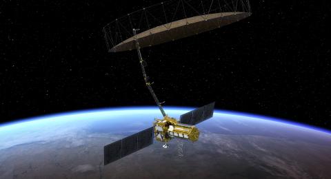
Upcoming spaceborne synthetic-aperture radar (SAR) missions—like the NASA-ISRO Synthetic Aperture Radar (NISAR) mission— promise frequent monitoring of the Earth’s surface, with high-resolution images regardless of cloud cover and other weather conditions that affect conventional satellite imagery. This emerging technology and data can offer an important new mapping tool of forest biomass and other attributes used in informing land management. However, common methods of analyzing SAR data may not lead to accurate estimates of forest characteristics. This study assessed why existing methods may lead to errors and points to ways that the new technology could be used for better forest biomass estimation.
Estimating forest biomass from SAR data
The launch of the NISAR mission will provide freely available L-band SAR, which can penetrate clouds and provide observation of the Earth’s surface every 6 days. As a result, this mission has stimulated interest in the use of SAR for forest monitoring, including the assessment of aboveground biomass. To do so, however, scientists and practitioners must use statistical methods to interpret satellite-derived data in a way that provides useful information.
Statistical models are used to convert SAR backscatter—the pattern of radar signals that are emitted by the satellite and reflected from the tree canopy and other surfaces—into predictions of forest characteristics, such as biomass. SAR backscatter is driven by interactions with water in vegetation and other surfaces. Much of the work on the recovery of forest biomass from SAR involves the Simple Water Cloud Model (SWCM), developed by Evert Attema and Fawwaz Ulaby in the 1970s. Using the correct statistical approach is crucial to ensuring that the results—often presented as a map of forest biomass—are accurate.
All model-fitting methods rely on collecting an appropriate set of biomass data at known locations in the field, then extracting backscatter or other SAR variables for those locations from the satellite data. Much of the previous research on biomass mapping using SAR relies on a model inversion technique. In inversion, the parameters of a model such as the SWCM are chosen to give the best predictions of backscatter based on the observed biomass values. This gives an equation between backscatter and biomass. Then, new backscatter values are used to map and predict biomass using the fitted equation.
The inversion approach is intuitive, but it depends on a dubious statistical assumption—that the relationship between SAR backscatter data and biomass is perfectly or near-perfectly predictable. However, that is not the case. As such, the widely used inversion method may not provide the most accurate predictions of biomass.
An alternative is to predict biomass directly. By using the paired field and satellite data, parameters of the SWCM are chosen to give the best prediction of observed biomass. The resulting equation, which will be different from that obtained in the inversion approach, is then used to predict new biomass values from a map of observed backscatter.
Testing the methods
This study compared the accuracy of aboveground biomass predictions using the inversion and direct methods with field data collected from 175 forest plots in New Hampshire and Maine. In the comparison, a technique called leave-one-out-cross-validation (jackknife) was used so that biomass at the plot being predicted was independent from the values used for model fitting. The results clearly show that the inversion technique provides poorer predictions; however, the direct approach for predicting biomass nearly eliminates bias and cuts root mean square error and mean absolute error nearly in half (Table 1).
A weakness of the direct approach is that its results do not shed light on the physical performance of a sensor design—one of the strengths of the inversion method. The two approaches are complementary and the purpose of an investigation should dictate which will be used. Where prediction of biomass is the main goal, the direct fitting technique is preferable.
Related published research
- Remote Sensing: Assessment of Forest above Ground Biomass Estimation Using Multi-Temporal C-band Sentinel-1 and Polarimetric L-band PALSAR-2 Data
- IEEE International Geoscience and Remote Sensing Symposium IGARSS (2021): Choosing the Dependent Variable in SAR Backscatter – Forest Biomass Models
- Remote Sensing of Environment: Integration of allometric equations in the water cloud model towards an improved retrieval of forest stem volume with L-band SAR data in Sweden
- Remote Sensing of Environment: Mapping forest aboveground biomass in the Northeastern United States with ALOS PALSAR dual-polarization L-band
- Remote Sensing: Research Pathways of Forest Above-Ground Biomass Estimation Based on SAR Backscatter and Interferometric SAR Observations
- Radio Science: Vegetation modeled as a water cloud
This material is based on work supported by the NH Agricultural Experiment Station through joint funding from the USDA National Institute of Food and Agriculture (under Hatch award number 1020142) and the state of New Hampshire. Authored by M. Ducey.


