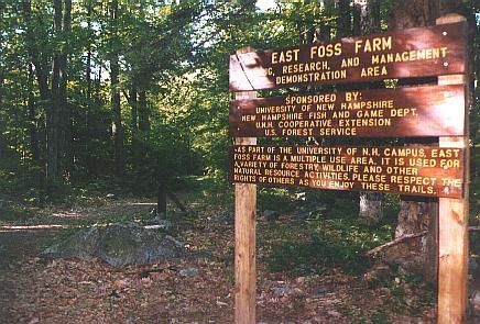
Introduction
The East Foss Farm, located on Foss Farm Road in Durham, NH, is a 164-acre tract of land managed for multiple uses, including teaching, research, wood production, and wildlife. There are seven major habitat types within the East Foss Farm property: clearcut, early successional, mature hardwood, mature softwood, riparian, and wetland/shrub swamp. East Foss Farm is frequently visited by UNH faculty and the student body to observe the different forest management techniques that have been used on this land. A trail system provides access to the property.
History
East Foss Farm has been a farm since the 1800s. Initially owned by Jasper R. McDaniel, it was primarily used as grazing land. In 1888, George H. Amazeen took the deed of the property. It remained an active farm and was used for cattle grazing until the 1960s. Mr. Amazeen left the entire East Foss Farm property to the New Hampshire College of Agriculture and Mechanic Arts. In 1923, the University of New Hampshire took ownership of the Foss Farm upon receiving University status. Since then, the Woodlands office has managed
the now forested land. Selective timber cuts, some clearcutting, and prescribed burning have been utilized to benefit both wildlife and timber production.
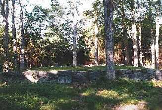
Cemetary in East Foss Farm (1998)
East Foss Farm is used extensively for education by UNH. Classes regularly practice timber harvest activities and prescribed burning. In 2013 an 8-acre area was cut to primarily produce habitat for the New England Cottontail, a threatened species. Paired with this is a research project that looks at control measures of the invasive shrub glossy buckthorn.
Present Uses
East Foss Farm is also used for recreational purposes, such as walking, running, hunting, and mountain biking.
Directions
Take Mill Road in Durham southwest until you reach Foss Farm Road (just before you reach the bridge that goes over the railroad tracks). Take a left on Foss Farm Road. Continue past the water tower approximately .1 miles to a dirt road on the right. Take this right, and at the gate, you have reached the boundary to East Foss Farm.
APPROXIMATE LOCATION: N 43°07.373', W 70°56.231'